• Ancient Digger teaches Archaeology and History to all Ages!

Friday, July 24, 2015

Exploring the Brimstone Fortress in St. Kitts


On a recent cruise to the Virgin Islands,  we visited St. Kitts, and took a tour of the island with Roysten tours. We snorkeled along the breathtaking barrier reef in two different secluded locations, and I had the chance to use my waterproof IPhone case for the first time. By the way, it worked pretty well before I went underwater, but once submerged, the phone didn't work at all. Hmm, perhaps not waterproof after all, or, maybe I misread the box which didn't say anything about taking it 6 ft down to take pictures of a school of tiger barbs. I digress…this is supposed to be about Brimstone Fortress. I'm getting to it.

One of our last stops on our St. Kitts tour was Brimstone Fortress. If you know me at all, you know I love fortifications. From the moment I placed my hand on the coquina walls at the Castillo de San Marcos, and just recently walked the streets of Old San Juan, nestled within its own massive fortification, I was fervently obsessed with the look and structure of these man made marvels. 

Brimstone was nothing short of a wondrous architectural feat. The Brimstone Fortress was constructed between the 1690s and 1790s, and remains of singular importance due to the complete military community that resided there during the 18th century.


I first ventured along the coast, and slowly stepped down into the infantry officer's quarters. This section of the fort was constructed in the late 18th century, around 1791. The famous arches allow for splendid views of the Caribbean.

It was one of my favorite buildings. I got lost, not physically, in the panoramic vistas. This area was reserved for regimental officers, who once resided in the masonry basements, once topped with timber buildings.


Here it was. As I made my way to the steps of Fort George Citadel, I had to take a moment to reflect. The fortress is virtually a man-made out growth of the natural hill. The steps to the top reminded me of the Great Wall of China, however the steps, albeit they were very far apart, and looked seemingly easy to navigate, were quite the contrary. 

I thought, hey, I've been swimming and building muscles, this will be a breeze. Phew, by the time I made it half way up, my heart started beating rapidly, and I had to take a breather. The slope of the steps and the elevation presented quite a challenge, but I pressed on. 

By the time I made it to the top, I had to take five minutes to control my breathing. Funny thing was, well, maybe not too funny, there were people in really great shape climbing this staircase, and they too were huffing and puffing the entire way up, and sharing water at the top. Keep in mind, the citadel is nearly 800 feet high, and one of the earliest surviving examples of a new style of fortification known as the 'polygonal system'. However, I wasn't thinking about the shape, I was thinking, "Man, I'm glad I made it to the top without falling over".

View from the Top of the Citadel: Brimstone Fortress


The walls of the structures are predominantly of stone, laboriously and skillfully fashioned from the hard volcanic rock of which the hill is composed. The mortar to cement the stones was produced on site from the limestone which covers much of the middle and lower slopes. 


By the time I finally caught my breath, I got a glimpse of the mountains, the historical township of Sandy Point, and neighbouring Dutch, English and French islands across the Caribbean Sea. It was spectacular, and mainly because I made it to the top without passing out, and actually got to enjoy it. I was up there nearly 20 minutes before my fiancé appeared. Either he got lost, or he took a breather like I did on the step. Either way, it was well worth the effort.


As educators, historians, archaeologists, and travelers, why is it that we find such joy in touching the oldest of structures? Perhaps we expect to feel the history, or some type of connection to the people that once roamed the grounds of these structures. For me, it really does represent living history. Today, most structures are built, not to last, but for purpose. Just look at the arches. Why was it necessary to create so many? Did the infantry really need that many entrances into the courtyard? Why does the design remind me of Ancient Greece? Ancient Rome?

It seems that all people borrowed from those before them, whether it was the method or mode of construction, or the theory behind the design. Either way, it's rewarding to experience a transfer of knowledge from one century to the next. Thousands of years have passed, and yet these structures all share similar voices. That's one of the things I really love about archaeology, and I love that Brimstone Fortress reminded me of that.

Sunday, July 29, 2012

31 Early Christian Tombs Discovered in Serbia


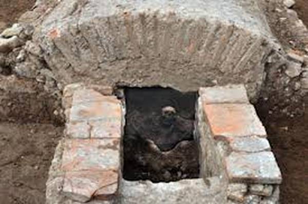
The remains of 31 early Christian tombs have been discovered during archaeological excavations in Nis, Serbia's third largest city in the southern part of the country.

"These are the most important excavations carried out so far on the site of the early Christian necropolis of Jagodin-mala", said Toni Cerskov, who heads the team of 45 archaeologists, architects, anthropologists, photographers and workers at the site.

The tombs are located under the former textile factory Niteks, the Tanjug news agency reports. Cerskov said the tombs are among the most important findings regarding the early Christian period and can be compared to the discoveries made in the necropolis of Pecs, Hungary, Solin near Split in Croatia, Sophia in Bulgaria and Thessaloniki in Greece.

Excavation work will continue until the end of July. (ANSAmed)

Thursday, December 29, 2011

Archaeology News: Is the Colosseum Collapsing?


The Colosseum may be a fixer-upper but it’s not collapsing according to the department of the Culture Ministry responsible for Rome’s archaeological sites.  “Nothing has collapsed” at the Colosseum “since the 18th century”.

Under closer investigation, it appears that some masonry chunks and bits of plaster have
detached and fallen on Tuesday. On Christmas Day tourists found small fragments of tufo, the porous rock typical of ancient Roman monuments, on the ground. Anna Maria Moretti, the official responsible for the ancient sites, denied that any material had fallen Tuesday and noted that the tufo that detached on Dec. 25 came from a patch smaller than “five centimeters.”

The Colosseum is about to undergo an extensive 25-million euro restoration — about $33 million – sponsored by Diego Della Valle, owner of the Tod’s luxury goods brand. Work is scheduled to begin in March.

Source

Saturday, August 13, 2011

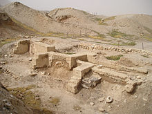
Jericho Unearthed - Bible Confirmed Once Again


Can archaeology prove the accuracy of the Bible? In this video, we hear from archaeologists about what is required to make an honest and intelligent assessment about the accuracy about the Bible.

Jericho Unearthed is a new documentary which assesses the validity of the Biblical record and the archaeological evidence, using incites from Garstang, Kenyon, and many other experts.

In the 1920’s archaeologist John Garstang concluded that he had matched evidence at the site to the stories in the Bible. His conclusions were challenged by archaeologist Kathleen Kenyon who explained that when the Israelites attacked Jericho as described in the Bible, there were no walls and no city.

Historian Sharon Woods explains that there has never been any archaeological evidence of the Bible in Jericho. For that matter, the wall that does exist is Middle Bronze Age and not Late Bronze Age.
Archaeologist Bryant Wood explains that “you have to come to a conclusion based on the evidence, not on what the authority figure says”.

What all of these archaeologists, scientists, and historians seen to have in common is that, you have to use concrete evidence and not the stories in the Bible to arrive at your conclusions.

Saturday, July 30, 2011

Archaeology News: July 30, 2011


Archaeologists give tentative name to shipwreck

Professional archaeologists may have finally solved the mystery behind a sunken steamboat in Bayou Bartholomew that has intrigued local residents for decades.

Tiny treasure hunters: Camp helps kids explore archaeology

Kids playfully fought over shoebox-sized containers filled with sand and hidden artifacts before settling down to examine their treasures at the Archaeology and Ancient World day camp's Mystery Dig Friday.

Archaeological dig planned for Mountwood

Members of the public will have the chance to participate in an archaeological dig at the former home of oil and gas pioneer WC Stiles Jr. Friends of Mountwood.

Team visits ancient archaeological site in San Fulgencio

A team from the University of Alicante have once again been visiting an ancient archaeological site in San Fulgencio believed to be an important early Iberian settlement.

Crowds out in force to see the past unearthed

OVER 1000 people turned up at an archaeology open day on the site of Doncaster's Civic and Cultural Quarter, at Waterdale. Visitors were given guided tours of the archaeological site and looked at displays.

OCEANSIDE: Library offers archaeology program

The Friends of the Oceanside Public Library hosts Annemarie Cox, education program coordinator of the San Diego Archaeological Center, presenting stories and photos of archaeological sites in North County.

Lewis expert to face ‘bear necessities’ in Viking research project

An expert in North Atlantic Viking settlements, Dr MacLeod Rivett is joining the Helluland Archaeology Project at Cape Tanfield, Baffin Island, on a site occupied over 1000 years ago by Paleo-Eskimos.

From Day of Archaeology’s Bristol Office

I am amazed, really very pleased, by just how many people embraced the idea of Day of Archaeology. Right now we have just under 360 posts published, with the promise of more to come. I’m told the #dayofarch hashtag was used over 900 times on Twitter during the day.

Tuesday, June 28, 2011

UNESCO Names New World Heritage sites


The United Nations culture body UNESCO has named World Heritage sites at eight locations across Italy dating from the Germanic Lombard people's invasions of the 6th-8th centuries AD, the UN said.

The eight sites dating from 568 - 774 AD are located in Castelseprio and Gorante Olona and Brescia in Italy's northern Lombardy region, in Cividale del Friuli in the northeastern Friuli district, in Spoleto and Perugia in the central Umbria region, and in Benevento and San Michele sul Gargano in the southern Campania and Puglia regions.

The Coffee Cultural Landscape of Colombia, the Archaeological Sites of the Island of Meroe in Sudan, Jordan's Wadi Rum Protected Area and the Fagus Factory in Alfeld, Germany were also named World Heritage sites at a meeting of UNESCO in Paris taking place through Wednesday.

[Thanks ADNKronos]

Wednesday, May 25, 2011

Adventures in Archaeology: IBM had a Problem


Guest Post By Geology Expert John Carter

Sometimes the use of GPR can be absolutely hilarious, consider this case in point. Several years ago IBM had a problem with a set of pipes carrying hydrogen gas from an above ground storage tank across the parking lot of their plant in East Fishkill, New York. The hydrogen is used in making computer chips. IBM had issued a contract for some archaeological excavation work to be performed in their parking lot. The contractor was given blueprints of the lot that showed two sets of pipes in different places after they had been told there were only one set of pipes.

Needless to say with the information supplied the contractor wasn’t sure of exactly where the pipes were. He became especially nervous after some of the officials at IBM had informed him that if he broke either of the pipes it would cost him $8 million a minute. He had heard about Ground Penetrating Radar, so he found out who manufactured the units, and put in a phone call to the manufacturer, Geophysical Survey Systems, Inc. of Salem, New Hampshire who had a policy of giving GPR jobs to the nearest owner of one of their units to the job site.


Presently we received a phone call from the contractor explaining his problem. We showed up bright and early the next morning with our unit, set the instrument up, selected the proper antenna for the job, and went trolling for the errant pipes. The antenna we selected looks for the entire world like a power lawnmower with an extension cord leading back to the unit in the van. After we had been going back and forth in the parking lot for a while we attracted some attention from the denizens inside the plant, and out came some junior executive who asked what we were doing.

We explained what we were looking for, and how the GPR unit worked, and with that he went back into the plant. About twenty minutes passed when several more executives came out from the plant including the general manager who invited us, and our GPR unit, to come back into the plant. We marked off with a can of spray paint where we stopped with the GPR survey, and followed them into the plant. The general manager explained to us they were having the same problem inside the plant with the same set of pipes, and they also having the same problem finding the pipes because they had two sets of prints showing the pipes in different locations.

IBM is one of the most high-tech companies in the world, but their best effort was a janitor with a pair of bent coat hangers dowsing for the pipes. We got an extra job out of the deal where everybody paid us by the hour for our services.


This is how GPR works: It is similar too your kitchen microwave in that it uses a cavity magnetometer to generate the radar micro waves, but the similarity to a microwave oven ends there. The power generated by a GPR unit is roughly 1/20,000 of the power generated by a microwave oven. The beam is not focused, so it is not like a searchlight, but more like a floodlight. GPR does not generate a sharp image like a camera, but rather an image produced by the radar waves acting against the difference in dielectric strength between the earth and any object buried in the ground. This produces an echo that is returned to the GPR unit that converts it to an image on some form of monitor where it can be interpreted by the operator into useful information about subsurface conditions. The readout can be either a digital image on a screen, from an archaeology site sometimes,  or a printout from a multichannel oscillograph.

Most GPR units use both systems together because the printout is hard copy that can be stored. The digital copy is also stored in some sort of device that stores memory.

Author Bio John Carter is a geologist that paid his way through college as a commercial helicopter pilot in the NY Metro area. He has had extensive experience as a prospector, and operated an environmental consulting firm specializing in environmental site assessments and is certified by the State of Connecticut as an Environmental Analyst III. In his early life he worked as an experimental machinist on aircraft and electronic parts before receiving his degree as a geologist. Carter also owns the website Gold Mining and Prospecting.

More of John Carter’s Articles

How to Layout a Claim with GPS

I own a Garmin 90 handheld GPS unit that is designed for use in aircraft that although it doesn’t have all the “bells and whistles” as newer models used for navigating on the ground even so it is quite capable of accurately laying out property lines, and corner locations that is exactly what is called for to layout and stake a claim.
How to Layout a Claim with GPS

Use of GPR at the L’Ambiance Plaza Disaster

L’Ambiance Plaza was a 16 story residential project that was under construction in Bridgeport, Connecticut at the corner of Washington Avenue and Coleman Street when its partial frame collapsed on April 23, 1987. There were 28 workers that were killed, caught between the sandwiched concrete floors of the collapsed building. The site was immediately swarmed by many of the construction workers from other projects in Bridgeport who tried to save trapped workers. From the start it was quite apparent that finding any survivors would be a miracle.
The Darker Side of Archaeology: Use of GPR at the L’Ambiance Plaza Disaster

The Environmental Site Assessment as an Archeological Study

An environmental site assessment (ESA) is a report mandated by law designed to establish the well being of any piece of property that in practice usually applies to commercial and/or industrial properties. An ESA is divided into three parts called phases that are numbered I, II and III. A Phase I report is used to determine whether or not the possibility of a release of hazardous material has in fact occurred on a property by determining its prior history.
The Environmental Site Assessment as an Archeological Study

Resources
Photos are in Public Domain

Thursday, May 19, 2011

Stone Circles of Avebury


Like Stonehenge, the Stone Circles of Avebury archaeological site have retained a somewhat mysterious reputation. In fact, up until the 19th century, people would circle the monument, or dance around the maypole as it was called, in one of the circles, possibly as a fertility ritual. There are several other ritual sites nearby, as the landscape of Avebury, is steeped in ritual context.

During the 1930’s Alexander Keiller investigated the Avebury Stone Circles and even raised some of the fallen megalithic stones. Although some of the famous stones were missing, Keiller replaced them with concrete blocks, resurrecting an archaeological site and bringing it back to life.

Read More: Stone Circles of Avebury, England

Photo source

Monday, May 16, 2011

Monday Ground Up: 5 Archaeological Sites That Changed The Face of History


To some, archaeology is merely the study of past worlds. Some may say that sifting through broken remains of decimated cities and exploring relics of forgotten peoples only provides us with interesting (and pointless) souvenirs from a time now inconsequential. While these artifacts and architectures are mere glimpses of the past, archeology provides us with a lens into what has been and could be. By exploring the material culture and environment of past human societies we are able to illuminate generalities about human civilization and social evolution. With most of human history occurring within prehistoric cultures without written language or record studying the material remains of those civilizations is the only way to learn about them. To be far too cliché, as Pearl Buck puts it, "if you want to understand today, you have to search yesterday." These five archaeological sites changed the face of history.

Machu Picchu

Machu Picchu

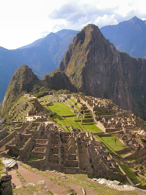
More widely known as the "Lost city of the Incas", this extensive archaeological site is located in southern Peru. Set atop a mountain that is only accessible by train or foot, this ancient city was the center of the Inca civilization. Discovered in 1911, Machu Picchu was built by the Inca around the year 1450, but was abandoned when the Spanish came. While many other Incan sites were defaced and plundered by Spanish conquistadors, Machu Picchu seemingly escaped discovery. Serving as a prime example of Incan civilization, Machu Picchu provided historians with new information about early indigenous society in South America. The site was made a UNESCO World Heritage site in 1983 and was named one of the New Seven Wonders of the World in 2007.

Petra

Petra

Known for its rock-cut architecture, Petra is Jordan's most visited tourist attraction. Carved into the side of a canyon in Arabah, Petra was originally discovered and made known in 1812. This site is believed to have had settlers as early back as the 6th century BC, but experienced rapid decline while under Roman rule. Petra was abandoned by the late 4th century. There are records of Petra in Egyptian military accounts as well as being part of the land mentioned in the Bible. Petra's complex water system provides compelling knowledge into ancient innovations for dealing with drought and flooding. The city has been a UNESCO World Heritage Site since 1985, has had award winning sonnets written about its magnificence, and was named one of the "most precious cultural properties of man's cultural heritage" by UNESCO.

Tikal

Tikal

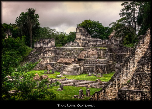
As the best-preserved ruins of the Mayan civilization, Tikal is one of the most important archaeological monuments in history. Located in Guatemala, Tikal was the capitol of one of the most powerful ancient Mayan kingdoms. Dating back to the 4th century BC, the city hit its peak from 200 to 900 AD as the center for Mayan politics, economy, and military. Because Tikal has been so well preserved, it has provided the most thorough insight into this ancient mega-civilization.
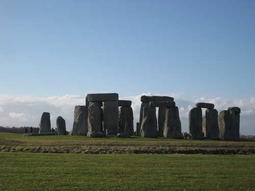
Stonehenge

Stonehenge

Located near Salisbury, England, this structure is over 3,000 years old. Like the Egyptian Pyramids, Stonehenge remains one of the most mysterious archaeological discoveries in history. With stones originating all the way from Wales, scholars are still unsure how the builders of the site transported the gigantic stones over such a great distance. One of the most famous sites in the world, Stonehenge is a circular setting of large stones. It is believed that the iconic site was erected sometime around 2500 BC, though historians and archaeologists are not completely certain. Added to the UNESCO list of World Heritage Sites in 1986, Stonehenge has become a national monument for England. Archaeologists believe that Stonehenge served as a burial ground; however its true function and construction remain a mystery.

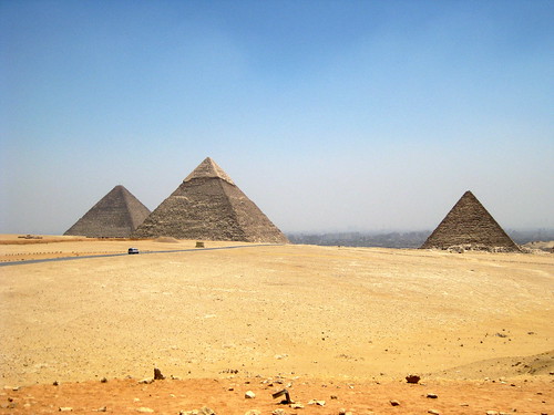
The Pyramids at Giza

The Pyramids at Giza

No list of ancient archeological sites is complete without a discussion of the infamous Pyramids. Built over 3,000 years ago, the Egyptian Pyramids remain among the most mysterious and aw- inspiring structures in the world. The Pyramids align to the stars and the solstices, containing vast chambers and rooms that are yet to be explored. As a true tribute to human engineering, scientists, historians, architects, and engineers still have no idea how the Egyptians made the Pyramids so precise. Built for ancient Egyptian Pharaoh's, the Pyramids of Giza in the outskirts of Cairo include three giant pyramids, known as the Great Pyramids, and the massive sculpture, the Great Sphinx. The Egyptian Pyramids have become an eminent part of popular culture as well as a telling story into a world of mystery and greatness.

About the Author:

Mariana Ashley is a freelance writer who particularly enjoys writing about online colleges. She loves receiving reader feedback, which can be directed to mariana.ashley031 @gmail.com.

Photo Credits

Thursday, April 28, 2011

Pyramids of Caral in Coastal Peru


In the mist of finals this week, I was assigned a video which documents the discovery and history of the archaeological site of Caral. If you haven't seen it, this is a short synopsis. Caral is located upstream on the coast of Peru.


Situated in the Supe River valley, Caral has a number of large buildings including the temple and circular sunken courts. Most likely there were irrigation canals enabling them to farm the arid lands around the river.


"The inhabitants of Caral, despite living many miles from the ocean, ate an enormous amount of sea food in their diet. They probably traded their agricultural crops for the marine resources obtained by people living in coastal towns and villages. Despite the large buildings and evidence for long-distance exchange in the Preceramic, there are no tombs or even elaborate houses".~Dr. Barber


Caral is unique in that is disproves Carneiro's warfare theory. In fact, no evidence has ever been found indicating warfare sparked the emergence of social complexity at this archaeologysite.


Watch this series about Caral as I'm sure you'll enjoy it as much I did.


Monday, March 7, 2011

Archaeological Discovery: Rare Human Skulls Found At Annigeri


Scores of human skulls found have been termed a ‘rare find' by archaeologists and historians.They reckon that it is a mass grave, but what makes it unique is the manner in which the skulls are arranged. 

Addressing a press conference here, Deputy Commissioner of Dharwad Darpan Jain, Director of the Department of Archaeology and Museums R. Gopal and historian M.S. Krisnamurthy said there was no report on the existence of such a mass grave so far.

Initially, only 50 skulls were found next to a drain after the ground was dug up for clearing the silt. As the finding caused a sensation, the administration cordoned off the area and requested the Directorate of Archaeology and Museums to conduct a study. A team of experts, led by Mr. Gopal and Professor Krishnamurthy, visited the site, but put off excavation because the area was damp. The excavation began on January 12 after the drain was diverted so as to allow the ground to dry. 


Thursday, March 3, 2011

Geoglyphology, A New Tool for the Archaeologist


Contributed By Arthur D. Faram

Over the past several years The Faram Foundation has been involved in the research and development of a new and emerging science. That science has been named Geoglyphology. Research has shown that this science has the power to rewrite history as we know it. During our research it was discovered that civilizations have secretly passed down a legacy of geoglyphs on the shores and highlands of land masses around the world. A well known example of this is the Nazca Lines in Peru. The reason the Nazca lines and other Geoglyphs were not discovered until recently is that they are too large to be seen from the ground. And so it is with most geoglyphs.

Until now the majority of the information available to the Archeologist is gleaned from the information recovered at the dig site. We discovered that a great majority of the ancient architectural, monolithic and geoglyphic structures built around the world had something in common. That commonality is that the structures were aligned in such a manner that the study of their linear alignment unveils a much larger story and immensely expands the data available to the archeologist and the related disciplines.

Extensive research on these geoglyphs, which exist on every continent and many islands around the world, have shown that, no matter when or where they were constructed, they all tie into a worldwide network of civilizations that have progressed, prospered and suffered setbacks for millennia. These glyphs range in age from the 10,000 year old Yonaguni Pyramid in Japan, to the 250 year old streets of Washington, DC USA.

Data recovered from these studies includes obtaining the geographical range of the culture being studied, the level of sophistication that existed in relation to their understanding of mathematics and geometry, their knowledge of world geography, the discovery of other archeological sites that were unknown prior to the studies, and the dating of the culture itself by the data collected at the offsite locations and the sophistication of the geoglyphs identified at the other dig sites.

It is our mission to assist the Archaeologist, and the related disciplines, in identifying any collateral data related to the dig site that might assist the Archaeologist in understanding the culture, or in expanding the search area.

More information can be obtained at: http://www.thefaramfoundation.com .

Arthur Faram's Biography


Arthur Faram was born in Fort Worth, Texas and moved with his parents, at the age of 13, to California. He later graduated from high school in Anaheim California. After graduation he joined the Marine Corps, serving 9 years and receiving the Purple Heart in Vietnam. When discharged from the military he was employed as a Computer Analyst and Certified Cartographer by the US Government. Upon retirement Arthur finished College and attended Law School to prepare himself for starting his own business.
Now that Arthur is retired he has the time to research the stories that his grandfather told him about the Faram family when they lived in England. He not only found out that the stories were true but was led into a family history that is more amazing than anything he could have imagined. It was while compiling and verifying his family history that he discovered the Geoglyphs which now form the nucleus of his research.

Monday, January 24, 2011

Monday Ground Up: Angkor Wat Is The Temple of Time


This article is contributed by Lima. 
 

For 800 years the temples and shrines of Angkor Wat have stood as a symbol of the nation of Cambodia. So much so that Angkor Wat appears on the Cambodian flag, its beauty and magnificence a source of national pride.
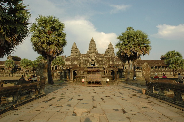
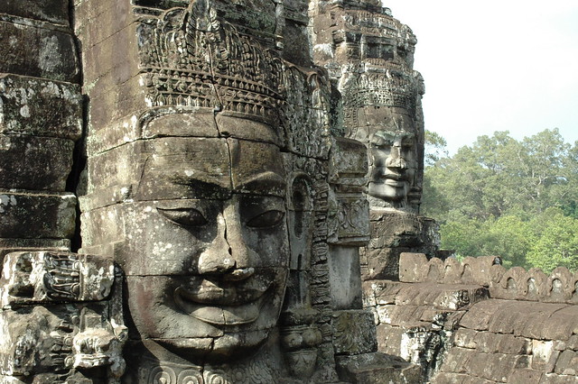
The temples at Angkor Wat, built in the early 12th century under the reign of King Suryavarman II, have been a center of religious worship continuously since its construction, making it the oldest site where religious activities have taken place uninterrupted.

Originally built as Suryavarman’s royal temple and center of the king’s court, Angkor Wat was constructed to honor the Hindu god, Vishnu. Angkor Wat was abandoned as the nation’s capital after it was attacked by an enemy clan within Cambodia at the time. A new capital was created and served as the royal center of power, leaving Angkor Wat to the local people who prayed in the temples that cover the 203 acres that comprise the whole of these magnificent structures built in the classic style of the Khmer.

In the 13th century, King Jayavarman VII was deposed by his son-in-law who had studied for 10 years in a Buddhist monastery and Cambodia quickly adopted Buddhism as the state religion. The Cambodian people were quick to accept this new religion that focused on the spiritual rather than material world. At this time, Angkor Wat became a shrine and a holy site for Buddhists throughout the region.

The original layout of the shrines and temples is clearly evident but construction at the site continued for almost four hundred years. As such, the complex is an architectural history showing change across four centuries – living history.

In that time, numerous buildings were added including decorative carved bas relief lines, many temple walls, representing the Hindu deities for which the temple was originally constructed. This centuries-long creation provides a trove of anthropologic information showing the evolution of the Cambodian culture and political structure. Even today, Angkor Wat continues to be one of the most researched sites on the planet. Its rich history is carved in the stone that makes up this mystical, awe-inspiring place.

The temples of Angkor Wat have remained sacred to the Theravada Buddhist sect into modern times and remain a place of great religious and spiritual power within the large segment of Buddhists that comprises the Cambodian population.

Over the centuries, the temples at Angkor Wat were gradually overtaken by the surrounding jungle and, in the early part of the 20th century, the site was in need of restoration. Recognizing the cultural significance of this remarkable series of shrines and spires, the world community came together to restore Angkor Wat to its former glory. Today, this holy place is not only a pilgrimage destination for Buddhists, it has become a major source of tourism revenue for Cambodia. The site is well-maintained and is, indeed, one of the wonders of architecture 800 years after work was begun.

The Significance of Design at the Site of Angkor Wat


Because Angkor Wat was built as a Hindu complex and center of state, the design of the complex is based on Hindu religious icons. The main temple is a representation of the home of Hindu gods, Mount Meru.

Surrounding the main temple are five spires that represent the five mountain peaks that surround Mount Meru. Angkor Wat was enclosed, the walls representing mountains. It was also surrounded by an immense moat, a representation of the sea. Thus, when the complex at Angkor Wat is taken as a whole, it becomes a representation of the world in miniature as it was known during the 1200s.


The walls of Angkor Wat are decorated, not only with bas relief depictions of Hindu deities, but also representations of the king and royal authority. However, archeologists suggest that many walls of the complex remain bare when work stopped on Angkor Wat upon the death of Suryavarman.

Many of these carved decorations depict known science at the time, particularly astronomical signs and symbols leading some anthropologists to suggest that Angkor Wat was more than a palace for Suryavarman and a private religious sanctuary for the king and his inner court.

Some anthropologists suggest that many of the bas reliefs that adorn the temple walls make a political statement as well as a religious one, pointing to a new era of learning, engagement and a contented populace, something that any monarch would desire.

The design and layout of Angkor Wat remain somewhat of a mystery. Khmer temples are built facing the east. The temples at Angkor Wat are oriented toward the west, the source of some controversy among the anthropology community. Some experts believe that the unusual alignment of the complex indicates that Angkor Wat was intended to serve as the burial site of its builder, Suryavarman.

Other anthropologists believe the alignment of Angkor Wat is more likely based on the deity to which it was originally constructed, Vishnu. In Hindu religious texts, Vishnu is associated with the west and, therefore, the western alignment of Angkor Wat makes sense despite its contrary positioning to other Cambodian temple sites.

Do the Features of Angkor Wat Suggest Engagement With Aztecs or Egyptians?


Using architecture and the advent of architectural innovation, anthropologists attempt to uncover connections between diverse cultures.

While there is no evidence to suggest that the design of Angkor Wat is imitative of the great pyramids of the Egyptians, Incans or Mayans, some within the anthropology community point to Angkor Wat as an example of cultural transference – the exchange of technology, linguistics and other elements that define diverse cultures.

Some experts point to the alignment question as an indicator that Angkor Wat was a Cambodian adaptation of either Egyptian or Mesoamerican civilizations. Others point to architectural innovations that appear in the design and construction of newer buildings over the 400-year span that construction was undertaken at Angkor Wat.

In fact, the buildings at Angkor Wat follow traditional building practices seen in other temple sites throughout the region. There’s no need to speculate how Cambodian architecture evolved. The evidence still stands, available for further study and analysis.


The Magic of Angkor Wat


However, this remarkable place is more than a collection of buildings. It is more than a site of archeological study. It is more than the cause for debate among anthropologists.

In today’s high-tech society, Angkor Wat stands as a true wonder. It has been described as mystical, magical and “almost surreal” – sentiments expressed by Westerners upon visiting the site for the first time. This is the true appeal of Angkor Wat.

Indeed, its history and construction are important to understand. However, it is the mysterious and the dynamic energy that emanates from this sacred spot that is the true story of this collection of holy buildings.
Angkor Wat is truly the world’s Temple of Time.

Also check out Lima’s article

Evolution of Culture, Genetic Anthropology, and the “Eve Theory”

For decades, anthropologists have debated “The Eve Theory” – the theory that world cultures migrated and evolved from a single source – Eve, a reference to Adam and Eve mentioned in the Bible’s Book of Genesis as the first man and woman and the progenitors of all human life.
Read more: Evolution of Culture, Genetic Anthropology, and the “Eve Theory”

This article is contributed by Lima, an avid traveler who owns a website offering high quality adjustable dumbbells for sale
Reference:
1st Photo © Adana Lima
Photo 2-4 © Cornstaruk

Sunday, January 23, 2011

Sunday Round Up: Top Archaeology and Anthropology News 1/23/2011


Archaeology

Anthropology

Sue Alcock From Brown University Discusses Petra at University of Texas

As stated by the University of Texas 'Archaeologist Susan Alcock will deliver a talk titled "Putting Petra in Landscape Mode: Alternative Archaeologies at a World Wonder," as part of the fourth annual William J. Battle Lecture Series. Alcock, director of Joukowsky Institute for Archaeology and the Ancient World, is Joukowsky family professor in archaeology and professor of classics at Brown University.

Read more: Sue Alcock From Brown University Discusses Petra at University of Texas

Chinchorro Mummies On Display in Santiago

A group of Chinchorro mummies are on display in 2008 in the cultural centre of the La Moneda presidential palace in Santiago. Switzerland has returned four mummies to Chile, including two of them among the world's oldest, after their private owner agreed to their restitution.

Read more: Chinchorro Mummies On Display in Santiago

Military Archaeology in Russia ww2

Simple Machines for Detachment 14th exploratory season in the "Valley" was going to be easy, but effective. Thanks to colleagues from Demyansk, under the leadership of Anatoly S. Pavlov, as well as in advance to visit the area scout and an experienced search engine Vadim Antonov, found a mysterious unaccounted dumping of Soviet soldiers being in combat strewn ditch full profile. Why mysterious? Will become clear later...

New Colonial Fort Discovered in St. Augustine

Only miles form where I live, there's always archaeological digs going on in St. Augustine, one of my favorite cities on earth. Of course, the greatest attractions for tourists, historians, and archaeologists alike in St. Augustine are the Castillo De San Marco and Fort Matanzas. Imagine my surprise to hear that a new colonial fort may be uncovered in the next few weeks, as archaeologist Carl Halbirt and a team of volunteers is uncovering the remains.

Read more:New Colonial Fort Discovered in St. Augustine

Following Johns Hopkins Egyptologist Betsy Bryan at Mut Temple

Johns Hopkins Egyptologist Betsy Bryan and her team of students, artists, conservators and photographers have returned to their investigation of Mut Temple, focusing their attention on the area south of the temple’s Sacred Lake. Bryan and her crew are resuming their excavation in Luxor, Egypt, and are sharing their work via “Hopkins in Egypt Today,” their popular digital diary offering a virtual window into day-to-day life on an archaeological dig. New posts will appear through the end of January at www.jhu.edu/egypttoday.

Read more: Following Johns Hopkins Egyptologist Betsy Bryan at Mut Temple

Destruction of Arizona's Heritage: Rock Art Vandalism

The defacing of rock art sites in Arizona has become a distressing and persistent reality, which must be addressed swiftly. To promote public awareness and debate about the preservation of rock art sites, a panel of archaeologists will discuss a variety of topics, including recent vandalism at Keyhole Sink; debates over rock art conservation models; Native American concerns about the destruction of cultural heritage; and stewardship of archaeological sites.

Read more: Destruction of Arizona's Heritage: Rock Art Vandalism

Saddleworth's Archaeology Collection on Display

The historical collection of a WWI officer from Saddleworth has gone on display, showing how ordinary people helped progress modern archaeology. 'The Story of Francis Buckley' at Gallery Oldham gathers together many of its titular archaeologist's treasures. Born in 1881, the former barrister became an expert on subjects such as English glass and Stone Age flints. Senior curator Dinah Winch said Francis "amassed the most amazing collection" in his lifetime.

Read more: Saddleworth's Archaeology Collection on Display

Finding Would Reveal Contact between Humans and Gomphotheres in North America

Mexican Archaeologists discovered 3 Clovis projectile heads associated to remains of gomphotheres with an age of at least 12,000 years, in the northern region of the Mexican state of Sonora. The finding is relevant because these are the first evidences in North America of this extinct animal linked to the human species. The finding opens the possibility of the coexistence of humankind with gomphotheres, animals similar to mammoths, but smaller, in this region of America, which contrasts with theories that declare that this species disappeared 30,000 years ago in this region of America and did not coexist with humans.

Read More: Finding Would Reveal Contact between Humans and Gomphotheres in North America

Smart Drug Dealers Know Their Target Audience’

Thomas "Biggie" Zenon and Miguel "G" Guzman were drug dealers. Specifically, they sold weed and high-grade cocaine. "Who in this city uses those kinds of drugs?" they asked themselves. White folks, they decided. College students and graduates with a higher-than-average median income who hate Rudy Giuliani but love Lady Bunny, spicy foreign foods, and movies in the original Swedish. Aha! Village Voice readers!

Read More: Smart Drug Dealers Know Their Target Audience’

Neoliberalism alive and well

Acknowledging that there are different kinds of "capital" -- e.g. cultural -- anthropologist David Harvey denotes that the principal property is that of circulation, the analogy being to life blood. As the ideal, he speaks of 3 percent compound growth and 50-year cycles -- but which is limited for finite resources. We can assume we are here talking mainly about "money" and wealth or the equivalent, even if only as bookkeeping or computer entries.

Read More: Neoliberalism alive and well


A mother struggles to see past herself

Lucy” is a rare event in the theater – a play told from the point of view of an autistic girl who, at 13, is getting to know her mother, a gifted and frustrated anthropologist once solely focused on advancing her career.
It’s an idea that makes Lucy into a modern missing link, and suddenly her name has resonance with another Lucy, the almost 4-foot-tall hominid skeleton from 3 million years ago. Through this comparison with hominid Lucy, Vivian’s daughter becomes a modern miracle – someone worthy of a mother’s love.

Read More: A mother struggles to see past herself

Scientists model ancient bog woman's face

German researchers have shed light on life during the Iron Age after examining the ancient remains of a woman found in a bog in what is now Lower Saxony. The body dates back to the pre-Roman era, more than 2,600 years ago.
A team of experts presented their findings on Thursday in Hannover, including facial simulations of the bog woman dubbed “Moora.” Archaeologists first began studying the find six years ago, according to news magazine Der Spiegel.

Read More: Scientists model ancient bog woman's face

Archeologists discover ancient ruins along Tanzanian coastal area

Tanzanian archaeologists and historical experts have announced the discovery of dozens of ancient ruins along the coastal area, dating back to as far as the 13th century. The new finds will shed new light on life as it was then, the identity of coastal dwellers, and possible trade with other seafaring nations across the oceans, in particular the Gulf area. It is believed from initial assessment that Arabic traders, and also the Portuguese in later centuries, had made landfall in what is now Tanzania and established settlements able to provide water and food to the ships and also trade for commodities in demand back then.

Read More: Archeologists discover ancient ruins along Tanzanian coastal area

Professionals Explain Rock Art Etiquette At Gold Butte Meeting

Around 1,500 years ago, a group of people lived and survived on the land presently called the Virgin Valley. People today know this because they left behind phenomenal petyroglyphs, commonly known as rock art, on sandstone. Although archaeologists gather theories as to exactly who these people were or what these markings mean, the truth is no one knows for sure who they were, where they went or why they documented their lives on stone.

Read More: Professionals Explain Rock Art Etiquette At Gold Butte Meeting

Sunday, January 16, 2011

Sunday Round Up: Top Archaeology and Anthropology News 1/16/2011


Archaeology and Anthropology Latest Headlines

Chemical analysis confirms discovery of oldest wine-making equipment ever found

Analysis by a UCLA-led team of scientists has confirmed the discovery of the oldest complete wine production facility ever found, including grape seeds, withered grape vines, remains of pressed grapes, a rudimentary wine press, a clay vat apparently used for fermentation, wine-soaked potsherds, and even a cup and drinking bowl.
The facility, which dates back to roughly 4100 B.C. — 1,000 years before the earliest comparable find — was unearthed by a team of archaeologists from Armenia, the United States and Ireland in the same mysterious Armenian cave complex where an ancient leather shoe was found, a discovery that was announced last summer. ~UCLA Newroom, From Stone Pages

2011 Excavation List For Excavation In Israel Just Published

Israel's Foreign Ministry posted a preliminary list of archaeological excavations scheduled for 2011. The ministry updates the posting periodically as new digs are notified to them. For ant one who wants to dig in Israel this is a vital piece of information.

This list of archaeological expeditions which accept volunteers is compiled by the Israel Foreign Ministry as a service to the public, and is not an endorsement of any of the projects listed. The excavation details below been published by the archaeologists in charge of the individual expeditions, who bear responsibility for their contents. ~ArchNews

Major Archaeological Project Examines Interactions That Changed China

The Oxford Centre for Asian Archaeology, Art and Culture, based in Oxford University’s School of Archaeology, has received its first major research award since its launch in October last year.

The Leverhulme Trust has awarded a grant of almost half a million pounds for the research project ‘China and Inner Asia (1,000-200 BC): Interactions that changed China’. The project, led by Dame Jessica Rawson, Professor of Chinese Art and Archaeology at the University of Oxford, will look at how the early Chinese societies made use of different foreign materials and technologies. Researchers will track how the Chinese, with their highly organised, relatively dense population, were able to react fast and on a large scale. ~Advert.co.uk

Antiochus VII, Antioch, January 17, 121 BC - Coining an eclipse of Jupiter by the moon

An unusual Greek coin, minted around 120 BC, may have marked a moment in time when people in ancient Syria saw Jupiter being blocked out by the moon.

On one side is a portrait of Antiochos VIII, the king who minted it. On the reverse is a depiction of Zeus, either nude or half-draped, holding a sceptre in his left hand.  Above the god’s head is the crescent of the moon, and his right arm is outreached with a star like figure (that may in fact be Jupiter) hovering just above his palm.

“Nobody ever re-used this iconography again – it was a one off,” said Professor Robert Weir, of the University of Windsor in Canada, who presented his research recently at the annual meeting of the  Archaeological Institute of America.

Culture thrived on future Iowa soil

About 800 years ago, an American Indian culture was concentrated in the Loess Hills near here.

Little is known about the people of what archaeologists call the Glenwood culture. They dwelled in earth lodges, lived on both sides of the Missouri River, and sometime around 1300 A.D. left — possibly being absorbed by the Pawnee or other tribes.

But two new grants from the Iowa Department of Transportation may help scholars and archaeologists learn more about the Glenwood culture people. ~Omaha World Herald

Primitive Peoples of Matto Grosso 1941

This awkwardly narrated black and white film from 1941 shows Anthropologist George Rawls interacting with the Bororo people of Brazil.

This movie is part of the collection: University of Pennsylvania Museum of Archaeology and Anthropology Films at http://www.archive.org

Wednesday, January 12, 2011

2012 World Monuments Watch Nominations


The World Monuments Watch calls international attention to cultural heritage around the world that is at risk from the forces of nature and the impact of social, political, and economic change. From archaeological sites to iconic architecture, cultural landscapes to historic urban centers, the Watch identifies places of significance in need of timely action.

Sites such as Machu Picchu in Peru, the sugar plantations of Florida, Ggantija Caves in Malta, are full of inspiration and dying history. Most of us are attempting to keep history alive by collaborating with institutions around the globe. Promoting awareness and providing effective solutions is what it takes. We need your help and your vote

Every two years, World Monuments Fund (WMF) accepts new nominations to the Watch. Over 600 sites on all seven continents have been included in the eight Watch cycles since 1996. Watch listing provides an opportunity for sites and their nominators to raise public awareness, foster local participation, advance innovation and collaboration, and demonstrate effective solutions.

The announcement of the 2010 Watch was covered by over 1500 news outlets, reaching more than 250 million people worldwide. The Watch nomination process also serves as a vehicle for requesting WMF assistance for select projects. Watch sites in more than 80 countries have received WMF support totaling $60 million, and WMF’s investment has leveraged an additional $150 million in assistance from other sources.

Information about the 2012 World Monuments Watch can be found at WMF

Guidelines for Nomination can also be found at the WMF site.

Questions about the nomination process should be directed to watch@wmf.org.

Information  via Barnea Levi Selavan

Like Ancient Digger? Why Not Follow Us?


Subscribe Via RSS Feed Follow Ancient Digger on Facebook Follow Ancient Digger on Twitter Subscribe to Ancient Digger Via Email

Get widget

Search


Ancient Digger Archaeology Copyright © 2015 LKart Theme is Designed by Lasantha